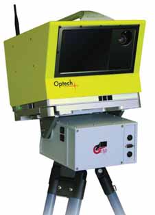
New Software Speeds Laser Scanning Time


Optech, a provider of advanced lidar survey instruments, announced direct georeferencing and improved survey-oriented workflow for ILRIS-3D scanners. This new control software, according to the company, enables point clouds to be directly geo-referenced from each setup location and provides a fully automated process to find field survey targets. The new feature enables geo-referencing, resection and back-sight functionality, allowing users to dramatically cut data collection and post-processing times. The ILRIS-3D controller will automatically calculate the geo-referenced positions of all future scans from that location. The system will also provide direct real-time confirmation of each scanned target and allow the operator to accept it based on the resulting data quality. Optech’s ILRIS-3D is a portable, laser-based three-dimensional ranging and imaging system for the commercial survey, engineering, mining and industrial markets.

www.optech.ca


As featured in Womp 08 Vol 10 - www.womp-int.com