Software Extends 3D Environment
Encom’s recently released Discover 3D 2.5
for MapInfo Professional delivers to geoscientists
a range of productivity tools and
enriched interactive 3D display capabilities.
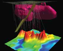
Discover 3D provides tools for interactive
analysis of drillholes, trenches, profiles,
mine models, terrain, geochemistry,
geophysical models, topography and geological
sections directly linked to a user’s
GIS work environment. Visualization
enhancements include 3D performance,
transparency management, volume clipping,
object selection and new data object
links. Discover 3D creates and edit points,
lines and polygons in 3D to add interpretive
elements directly to the 3D volume. It
uses these objects to create features such
as 3D fault surfaces, interpretive geological
surfaces, untested target volumes and
resource outlines.
www.encom.com.au/Discover_3D